-
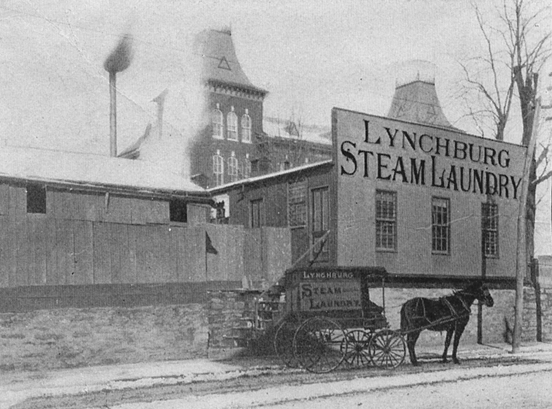
Lynchburg Steam Laundry
Stood near corner of Fifth and Madison. Note the towers of Bigger's School in the background.
-
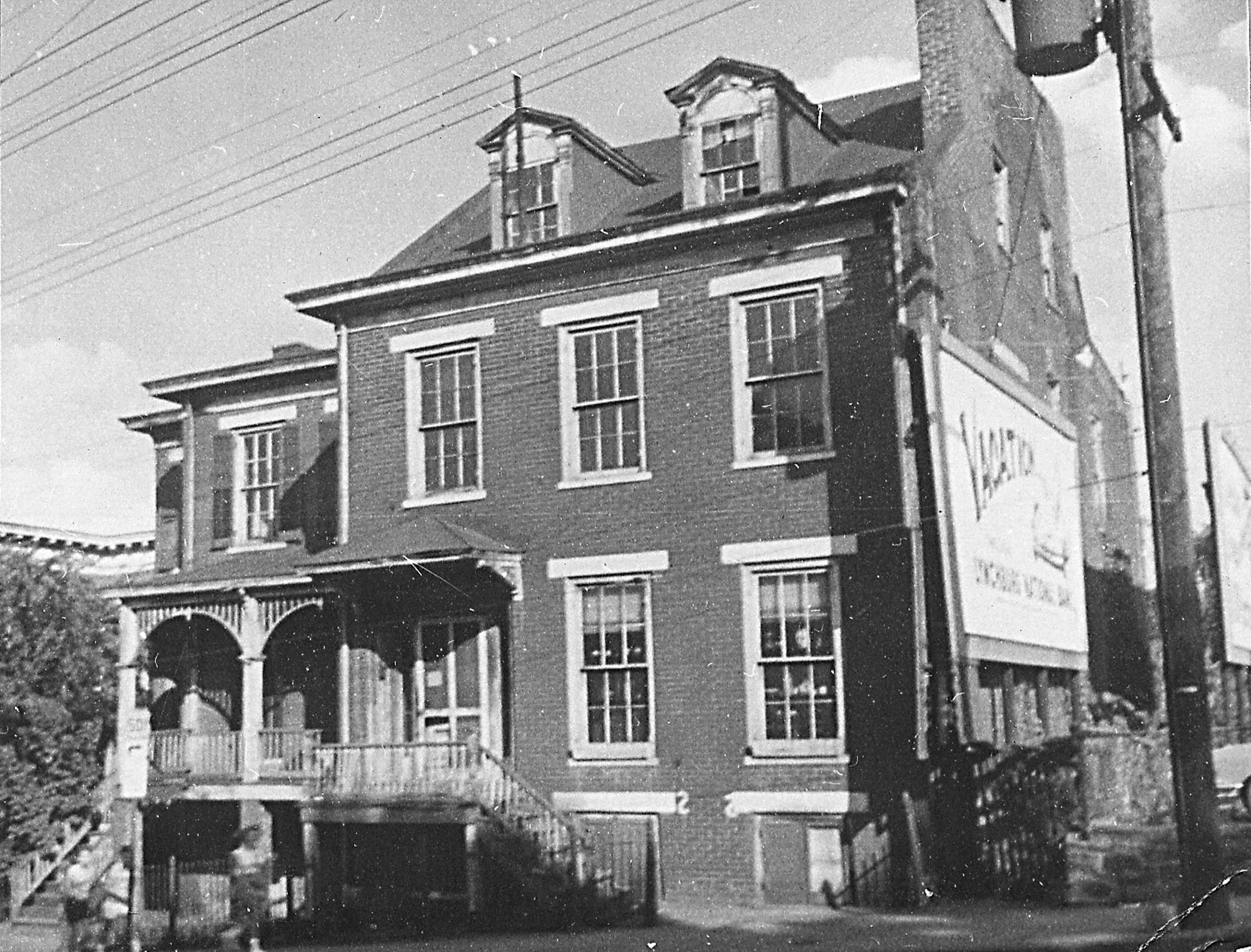
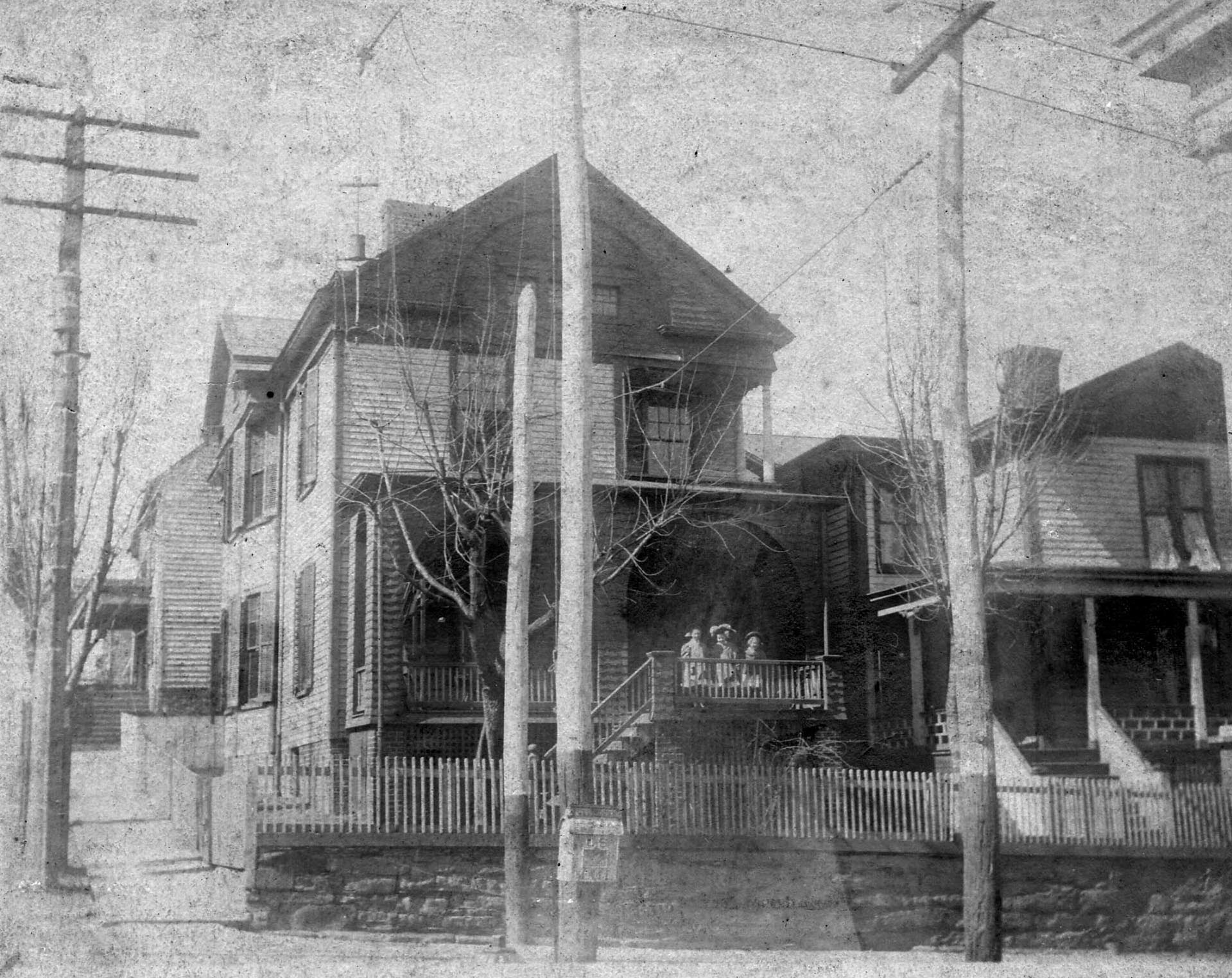
Fifth Street Residential
Between Church and Court Streets.
-
The Kentucky Hotel
-
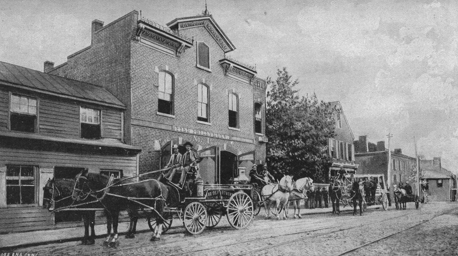
Fire Station
-
Western Hotel
Also known as Nichols Tavern
-
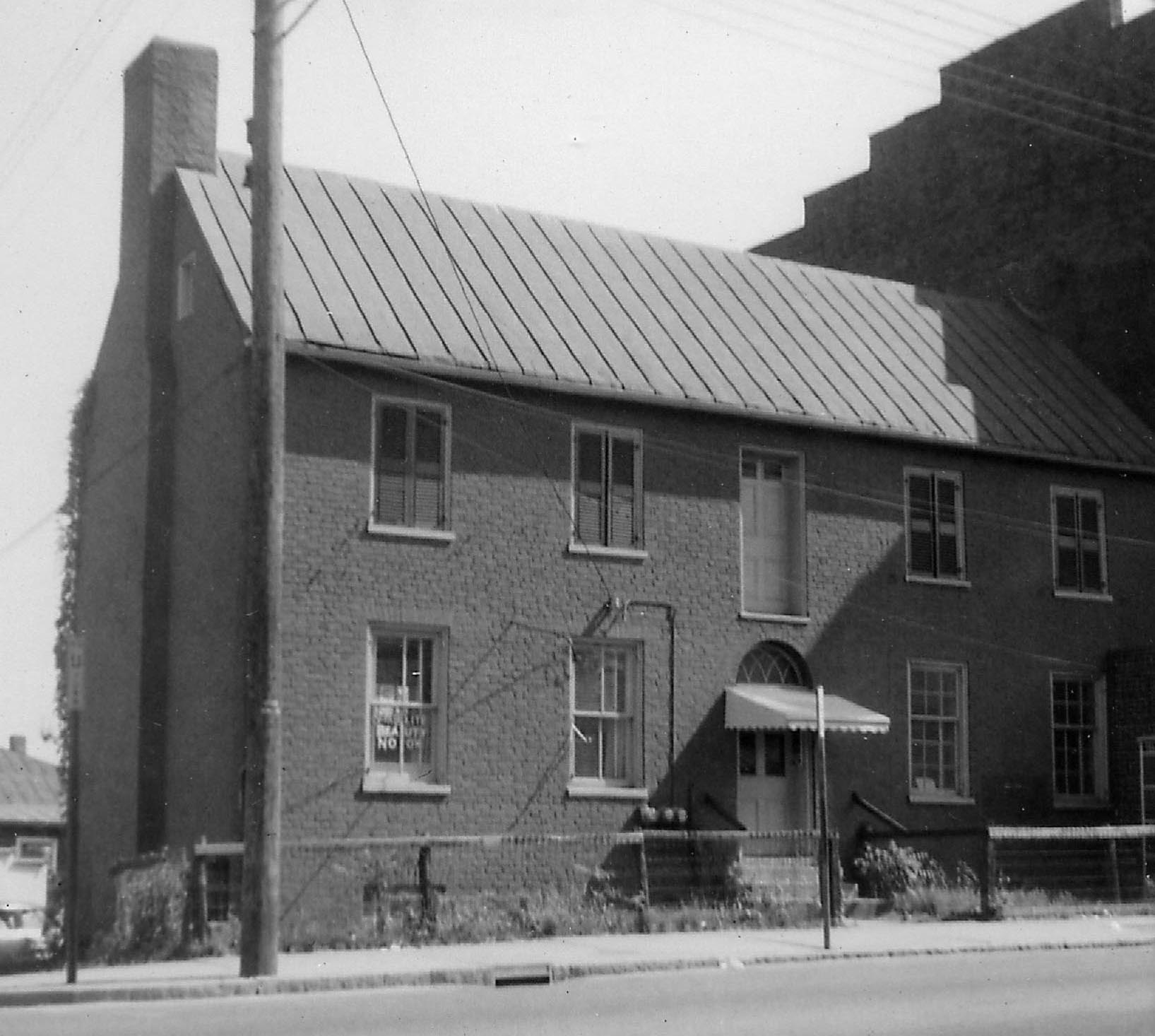
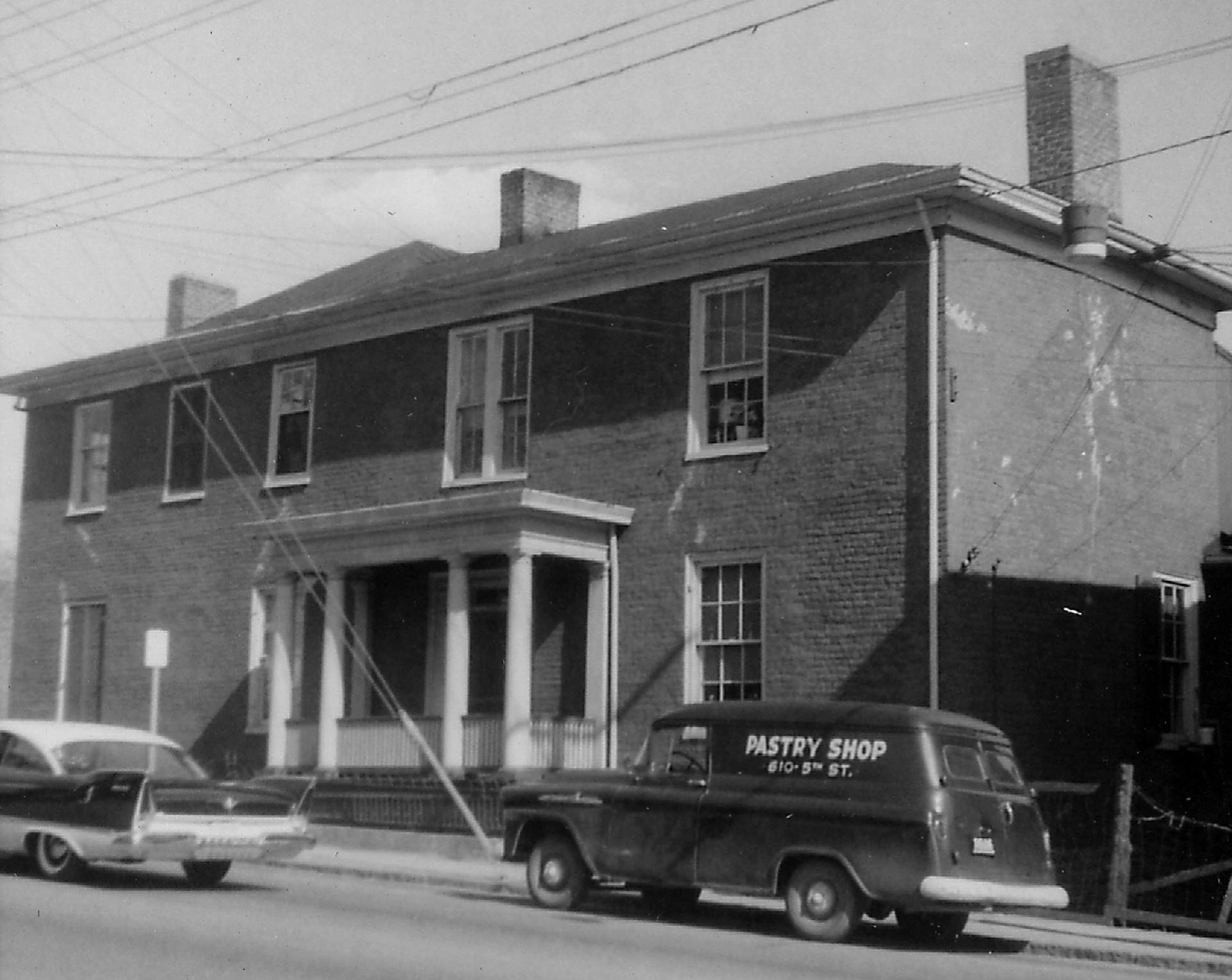
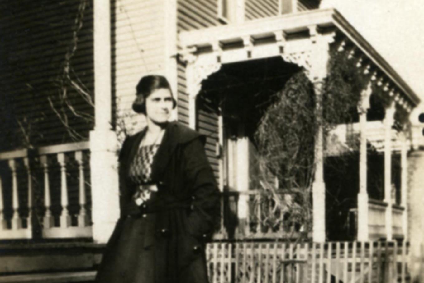
Fifth Street Residential
417 Fifth Street. Still standing at corner of Clay and Fifth.
-
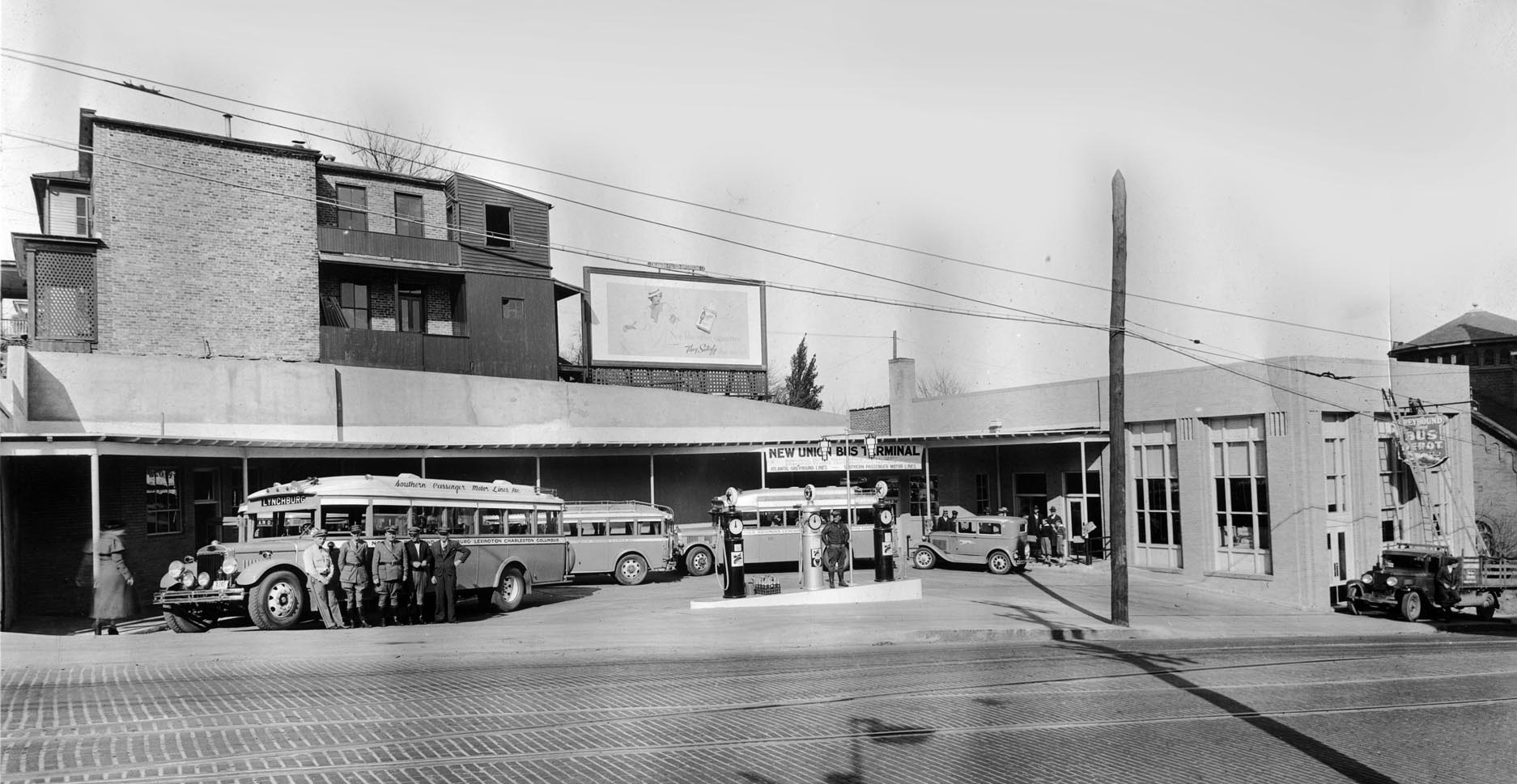
Union Bus Station
Between Main and Church Streets
-

Old Mason's Hall
Moved from Church and Ninth to Church and Fifth, and became the home of Colonel August Forsberg. 211 Fifth St.
-

Bell House
317 Fifth St.
-
Residential Duplex
502 Fifth Street
-
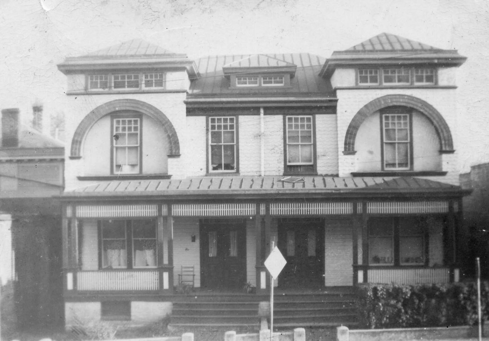
Fifth Street Residential
715 Fifth Street
-
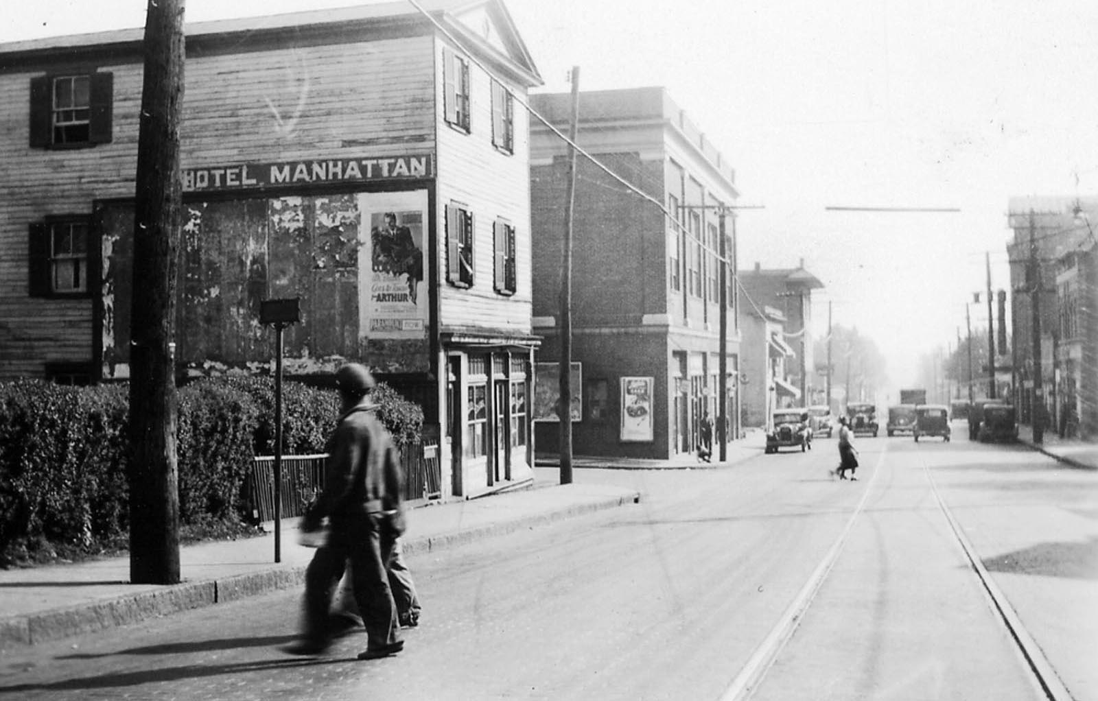
Hotel Manhattan
At the corner of Fifth and Polk Streets, 1930s
-
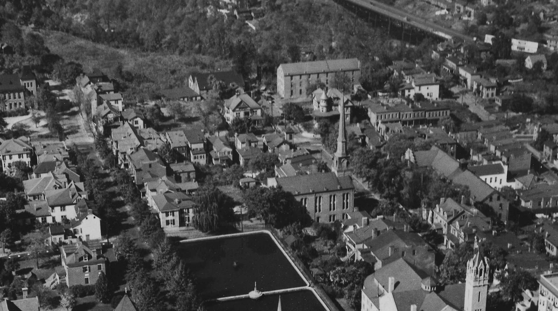
Tobacco Factory
This 1923 aerial shows many of the buildings along Fifth Street.
In the early 19th century the road now called Fifth Street was Lynchburg’s western gateway. Once called West Street, the route was also known earlier as Seventh Alley and Cocke Street. The names of two of the street’s oldest buildings, both dating from about 1815, reflect this westward orientation. The Kentucky Hotel, located at Fifth and Jackson, and the Joseph Nichols Tavern, later known as the Western Hotel, at Fifth and Madison, originally offered travelers food and lodging. Both buildings are listed in the National Register of Historic Places. A third tavern, called “Travelers Rest,” once stood at the corner of Fifth and Court. As a heavily traveled western thoroughfare, Fifth Street offered prime opportunities to grocers, sellers of dry goods and ready-made clothing, and other retailers. Two buildings occupied by merchants before the 1830s still stand: 612 Fifth and 708 Fifth, also known as the “Red House.”
Historical Overview
show more
Historical Overview
The Fifth Street Corridor began its development in the early nineteenth century as a gateway to Lynchburg, connecting the booming town with points westward as evidenced by transportation-oriented businesses of the period with names like the Kentucky Hotel (118-0177) and the Western Hotel (118-0020). During the late nineteenth century, Fifth Street (also known variably as Seventh Alley, Cocke Street, or West Street) served as the site of uses that would seem to be incompatible; it hosted high-end residential areas for Lynchburg’s white population while at the same time serving as the principal scene of commerce for the area’s African American community. “The Negro in Virginia,” a milestone report published by the Virginia Writers’ Project of the Works Progress Administration in 1940, described Lynchburg’s Fifth Street along with Roanoke’s Henry Street, South Avenue in Petersburg, and Second Street in Richmond, as a place where “the ‘crowd’ may be found almost every evening… here is a little oasis – ‘our street.’ Race pride is triumphant; here one need bow and scrape to no one. Drug stores, cafes, barbershops, pool halls, grocery and clothing stores, news-stands and theaters…are operated for Negroes by Negroes.” In addition to serving as the center of African American business in the twentieth century, the corridor developed as a major automobile sales and service district, serving as host to filling and service stations, tire and auto parts stores, and automobile showrooms.
Commerce & Transportation
In January of 1805, the Virginia General Assembly adopted an act that incorporated the town of Lynchburg, thus allowing the mayor and common councilmen to become a “body corporate” which was authorized to erect public works and buildings. In addition, the act provided for the expansion of the original 1786 limits of the town, and new thoroughfares, including Seventh Alley (alleys ran perpendicular to the James River) were formalized. As the system of two-acre blocks, each containing four half-acre lots, spread westward, the winding old Ferry Road, which had provided access to Lynch’s Ferry at least since 1757, was merged with Seventh Alley. Thus, travelers heading westward to the communities of New London, Liberty (now Bedford), Salem, and the Cumberland Gap would cross the James River via Lynch’s Ferry (this ferry would be replaced by a toll bridge in 1812), proceed up Water Street (now Ninth Street), turn right on Second Street (now Main), and then left onto Seventh Alley (now Fifth Street). Seventh Alley headed up the long incline from the James River, crested what is now known as Court House Hill, and proceeded in a southwesterly direction, ultimately connecting with the New London Road (later designated as the Lynchburg & Salem Turnpike,or Fort Avenue).
Due to the volume of traffic coming from and going to the western parts of Virginia, Seventh Alley (now known as Fifth Street) was in a prime position for commercial growth. Until circa 1805, virtually all commercial activity in Lynchburg took place along what is now known as Main Street, as well as at the bottom of what is now known as Ninth Street where the ferry (and later toll bridge) crossed the James River. Between 1797 and 1805, 13 out of 14 non-residential Lynchburg properties insured by the Mutual Assurance Society of Virginia were located on Main Street. Around this time, Seventh Alley also became known as Cocke Street, probably because merchant and civic leader Thomas W. Cocke owned at least two lots along the corridor prior to 1805. Another alternate name for the route was “West Street,” which may have originated from the surname of West, but more likely because the street was the route taken to proceed in a westerly direction.
Not surprisingly,the popularity of the route as a transportation corridor also led to the construction of several taverns along Fifth Street in the second decade of the 19th century, which marked Lynchburg’s first building boom (which was tempered only by the financial panic of 1819). In 1814, James Mallory purchased lot number 395 (at the corner of what is now known as Jackson and Fifth Streets) from Israel Snead. The original three-bay section of the house at 900 Fifth Street (118-0177) may have been standing at this time, and Mallory likely expanded the house to its present five-bay configuration soon after he purchased the property. Mallory’s tavern would soon be known as the Kentucky Hotel, an obvious reference to the ultimate destination of many Fifth Street travelers, and was the primary landmark in the area, as an 1817 appointment of road surveyors refers to the “road leading by James Mallory’s (called West Street).” Jacob Feazle purchased the tavern from Mallory in 1826 and then married Ann Cobbs, owner of 514 Polk Street (118-5318-0046), in 1829. Two years later, Jacob and Ann sold the tavern to Pleasant Partin for the respectable amount of $3,100. The Kentucky Hotel was listed in the National Register of Historic Places in 1986.
Joseph Nichols’ Tavern (118-0020) was built in 1815 and almost immediately burned due to sparks emanating from a blacksmith shop across Fifth Street. It was rebuilt in the same year due to an outpouring of support from the community, who raised more than $1,300 to assist Mr. Nichols and his family. Joseph Nichols was an experienced tavern keeper, as he was issued his first license in 1799, although the location of his previous tavern is unknown. Joseph and Lewis Nichols operated the tavern at 600 Fifth Street through 1822. John F. Johnson operated the business from 1824 until his death in 1843, when his widow, Mary, took over. She served as the tavern keeper until 1850, when she was listed as a resident in the household of Allen J. Black, a tavern keeper. During the Johnsons’ ownership, the tavern became known as the Western Hotel. The building was listed in the National Register of Historic Places in 1974.
In 1818, William Shaw began operating a tavern at his house (already well-known as “Travelers Rest”) at the southeast corner of what is now Court and Fifth Street. In particular, Shaw catered to children, as he noted that the property was convenient to three schools. Fisher’s Auto Parts Warehouse (118-5317) now occupies the site of Travelers Rest.
The presence of two extant taverns dating to the early 19th century is significant, as it is thought that only three taverns from the period remain in Lynchburg (the third being Major Oliver Towles’ tavern [also known as Cross Keys] at 1200-1204 Main Street). In 1816, at least 16 taverns operated in the town.
Naturally, retailers began to establish themselves along Fifth Street during the same period. Peter Detto may have operated a store (or perhaps even a tavern) soon after his 1805 purchase of a lot on the southwest corner of what is now Clay and Fifth Streets. In 1818, merchant Benjamin Perkins acquired the lot at the southeast corner of Fifth and Harrison Streets and promptly sold it to Archibald Robertson, surviving partner of Brown Robertson & Co. Scottish-born merchant William Brown, who died in the Richmond Theatre Fire of 1811, had numerous mercantile connections throughout Virginia, including at Otter Bridge in Bedford County, Milton in Albemarle County, and Manchester opposite Richmond. Following Brown’s death, Archibald Robertson took over a great deal of the business operation. Robertson operated several stores (including one at what is now Seventh and Main Street), and many of Lynchburg’s leading citizens were his customers. Thomas Jefferson was a longstanding customer of the firm, and at the time of his death in 1826, Jefferson owed $6,000, or 6% of his total debt, to Robertson. Robertson constructed at least two buildings on the lot, and merchant Lindsay B. Padgett purchased the lot from Robertson’s estate in 1844. Specializing in ready-made clothing and dry goods, Padgett operated stores on both Main Street and Cocke (Fifth Street). He owed substantial debts to many individuals and companies, and mortgaged his real and personal properties in order to secure the debts. Padgett apparently defaulted on the note, and an October 1847 Lynchburg Virginian advertisement announced the public sale of his property, including “all ready made clothing now in his store on Cocke Street.” Retail grocer James M. Cochran purchased the store building, then referred to as the “Red House,” at 708 Fifth Street (118-5318-0027) in 1849.
Another early store is located at 612 Fifth Street (118-5318-0018), and was probably built by Lilbourn Johnson in 1827. The previously-mentioned merchant Lindsay Padgett purchased the building around 1839. Like Federal period taverns of Lynchburg, store buildings of the period are very rare in the city, and these two buildings are part of a group of less than half a dozen extant and recognizable pre-1830 commercial buildings in Lynchburg.
In his 1835 gazetteer of Virginia, Joseph Martin noted that the “Lynchburg and eastern turnpike, running S.W. through New London and Liberty, is now completed half the distance.” The macadamized road “enters Lynchburg at the lower [eastern, or downriver] end of town. To accommodate the wants of the other end, an arm has been constructed from Cocke, or West Street (the northernmost alley) intersecting the turnpike a mile and a half from town.” The turnpike mentioned was also known as the Lynchburg & Salem Turnpike, and entered Lynchburg by the route of current Fort Avenue, which turned into Twelfth Street. An 1825 map submitted to the General Assembly shows that “7th Alley or Cocke or West Street” turned into the “Road to Bedford,” and that a road that “connects with [the] Turnpike” veered off of it well after it left the town of Lynchburg (the outer limits were marked by what is now Taylor Street). Using this map and Martin’s description, it can be ascertained that the “Road to Bedford” followed what is now Fifth Street along its present course southwest of College Hill, then followed Memorial Avenue to the vicinity of the present E.C. Glass High School, where it turned to the west and followed the course of Lakeside Drive and Forest Road. The road that, in 1825, connected Fifth Street with the turnpike, followed the course of modern Memorial Avenue, and intersected the turnpike at what would later become the site of Fort Early. Fifth Street businesses likely fought for more convenient access to the Lynchburg & Salem Turnpike, as this route required two miles of travel between the edge of Lynchburg along Fifth Street before one intersected with the turnpike road. The “arm” that Martin described as accommodating the “wants of the other end” of town would have departed Fifth Street at its intersection with Monroe Street, and intersected the turnpike at the place called “Watering Branch,” exactly one and a half miles from downtown. This route, followed today by a portion of Park and Fort Avenues, only required Fifth Street residents to travel one mile before they reached the turnpike. This simple roadway improvement guaranteed Fifth Street’s continuance as a commercial center into the second half of the 19th century.
By the time of the Civil War, the Fifth Street corridor was home to a number of tobacco warehouses and factories. As casualties from the field began to pour into Lynchburg, which was quickly becoming a major hospital center, all large buildings in the city were appropriated for use as hospitals. By 1862, Reid’s and Booker’s warehouses, near the intersection of Fifth, Church, and Court Streets, comprised Division 1 of General Hospital Number 1, and Division 3 consisted of Burton’s Warehouse (on the west side of Fifth between Harrison and Federal) and Candler’s Warehouse, which was on the east side of Fifth near Polk. Many casualties from the hospitals throughout town were sent to what is now known as the Old City Cemetery (118-0027) at Fourth and Monroe Street for burial.
In June of 1864, Fifth Street played a supporting role in the defense of the city against an attack by Federal General David Hunter. Susan Leigh Blackford recounted that “General Breckinridge, with some troops, got here on Wednesday night, and as we saw them passing out West [Fifth] Street…the streets were lined with women, waving their handkerchiefs and cheering them on as they moved out onto a line on the hills west of the city.” Cadets from the Virginia Military Institute arrived on June 16th, and were ordered to dig defensive lines in the area of Fifth Street as it crested College Hill. That night, the cadets slept amongst the gravestones at the Old City Cemetery. The fighting on June 17 and 18 was primarily limited to the outer defenses, and Lynchburg’s inner defenses that stretched from the Old City Cemetery across Fifth Street, and along the ridge of College Hill, were not tested in battle.
After the Civil War, tobacco manufacturing continued along the Fifth Street corridor. An 1877 map of Lynchburg shows S.P. Halsey’s Prizery at the south corner of Fifth and Clay Streets. The Myers factory was located between Harrison and Federal near Fourth Street, and an unnamed factory was at the north corner of Fifth and Federal. A major complex of tobacco manufacturing buildings was next to the Kentucky Hotel (these were likely built by Pleasant Partin), while Hatcher’s factory was across Fifth Street on the north corner of Fifth and Polk. Lastly, a second facility owned by S.P. Halsey was on the south side of the intersection of Fifth Street and Park Avenue. Two examples of tobacco warehouses from the 19th century remain in the district. R.E. Gist’s Plug and Twist Tobacco Factory (118-0075) and A.M. Bruce’s Plug and Smoking Tobacco Factory (118-5318-0001) are both located in the 400 block of Court Street, and were constructed between 1877 and 1885.
show less